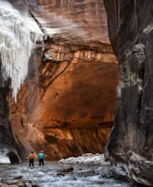
Winter Aglow in Southeastern Utah
Find your sense of adventure and awe in the vast yet intricate swaths of desert from Arches National Park to Monument Valley. From delicate river-fed ecosystems to crimson-hued rock buttresses, this magical landscape is awash in history, dating back thousands of years to the original Native American settlers to whom these places were sacred.
A journey through Southeastern Utah is an expansive, enthralling geological paradox: It's vast and wide-open..."empty." Yet, up close, this landscape bears the most intricate topography imaginable: deep twisting slot canyons, towering rock formations, winding rivers cutting through eons of rock layers and ancient dwelling sites bringing history within reach.
During the winter, the sense of awe is heightened. Not only are the dramatic red, orange and sandy desert hues brightly lit by the low wintery sun, but they may be topped with touches of white snow – a photographer's dream. In the "off" season, the summer crowds are long gone. It's just you. And the silent, crisp desert air.
This itinerary guides you through classic Southern Utah vistas, archaeological sites, geographic marvels, and sacred Native American lands, including the famed Bears Ears National Monument.
Keep in mind that, while winter is an extraordinarily beautiful time to visit this corner of the world, the roads can at times be wet, icy, or snowy, especially on some of the remote roads you'll be traveling. It's a very smart move to use a four-wheel-drive vehicle with good tires and plenty of water and snacks packed along. As any seasoned cowboy could tell you, you'll never regret bringing extra snacks. (Read: How To Visit Southern Utah in Winter)
Start: Green River or Salt Lake City
Finish: Mexican Hat
Hours of drive time: 11-14 depending on starting point; plan at least six hours for return to Salt Lake
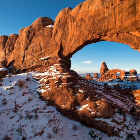
See Arches National Park in its full winter glory
103 Miles
- Winter in Arches National Park
- Hike Delicate Arch at its most peaceful
- Take a walk to Devil’s Garden
- Celebrate a gorgeous day with a burger and beer at Moab Brewery
- Top off the evening stargazing under a dark desert sky
If you're starting from the Salt Lake City area initially, drive south to Green River the night before your itinerary begins to shave three hours of drive time off your first day. If you can't, no sweat – just plan an early departure from Salt Lake to make the most of your time in Arches and Moab. Arches National Park is world-famous for good reason, which attracts quite the dense summer crowds. Now, mid-winter, you can truly take its wonders in with plenty of breathing room. Take a few short hikes: Delicate Arch is one of the most classic vistas in the state, so start there. Then add a walk through Devil's Garden if you can. (Read: How to Visit Arches)
Wrap the day warming back up in a cozy Moab hotel and fuel up with tasty pub fare and a pint. If you're up for it, inquire at the Arches Visitor Center about ranger-led stargazing for the evening. Arches and Dead Horse Point State Park both have International Dark Sky Designations, which means you can experience unforgettable stargazing there, free of urban light pollution.
Where to Stay
Moab
Tips for Prepared Travel
Moab is the last mid-sized town you'll be in for a while, so if you need certain grocery goods or outdoor gear supplies, this is where you'll want to get them. And, this may be a desert, but it's a high desert in winter. So pack lots of warm clothing, including a hat, gloves, long johns, puffy jackets and even microspikes to add traction to your shoes when the trail gets icy. And, keep your camera on hand...you probably won't put it away for the entire day.
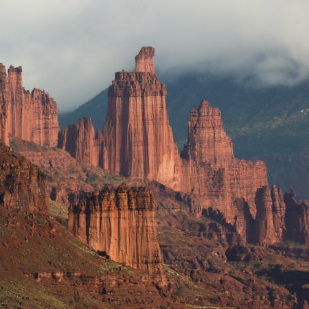
Wander the wonders of Castle Valley
37 Miles
- Hike Grandstaff Canyon to Morning Glory Natural Bridge
- Take a scenic drive along the Colorado River
- Hike around the base of Fisher Towers
Get ready for another big day, this time taking in the beauty of the Colorado River canyon east of Moab. Stop for a hike in the classic Grandstaff Canyon (just two miles each way, reaching one of the longest rock spans in the country, Morning Glory Natural Bridge).
Once you get to the Castle Valley area, you'll take a scenic stroll around Fisher Towers. This is one of the most exquisite hikes in the area because the towers and surrounding rock formations look different – and equally amazing – from every angle. The trail covers approximately 2.5 miles each way, so go the entire distance if you have the energy.
Wrap the day strolling the landscape around your lodging. Red Cliffs, Castle Valley Inn and Sorrel River Ranch are all delightful for a sunset stroll overlooking the red rocks.
Where to Stay
Castle Valley area: Red Cliffs Lodge, Sorrel River Ranch or Castle Valley Inn
Tips for Prepared Travel
Some of the rooms at the lodges listed above have kitchenettes, which are useful for prepping snacks and meals. Call ahead to inquire and make sure there's a good dinner option available. There's a tasty restaurant at Red Cliffs Lodge called The Cowboy Grill, which is open most of the year, but typically closes for a month mid-winter.
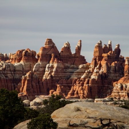
Peer into the wilds of the Canyonlands Needles District
165 Miles
- Explore the nature trails from Needles Overlook point
- Read ancient history at Newspaper Rock
- Drive Spanish Valley and the Needles Overlook Road
Fuel up and get ready for a day that won’t disappoint, start to finish. Take in an incredibly scenic drive along the base of the La Sal mountains through Spanish Valley toward Monticello and Blanding. Stop for a side-trip down Needles Overlook Road to get an up-close look at one of the most beautiful and remote corners of Canyonlands National Park, the Needles District. You can take a short hike from Needles Overlook Point, keeping your camera close at hand.
As you make your way toward the town of Blanding, you’ll gain elevation and encounter even cooler temps than you did in Moab. Bundle up and make sure your vehicle is up to the road conditions. You’ll want to make a stop at Newspaper Rock, which features one of the heaviest concentrations of Native American petroglyphs in the region. This rock panel offers an unforgettable peek into history, as it was used for thousands of years as a recording spot for the area’s earliest inhabitants. The name in Navajo is Tse’ Hane, which means “rock that tells a story.”
Where to Stay
Blanding or Monticello
Tips for Prepared Travel
You’re officially in small-town rural Utah in the quiet season, so call ahead on both lodging and restaurant options. There are a few diners open year-round, but make sure their hours align with the day(s) of the week you’ll be there. There are also two nice small grocery stores in Blanding so you can stock up on supplies and snacks.
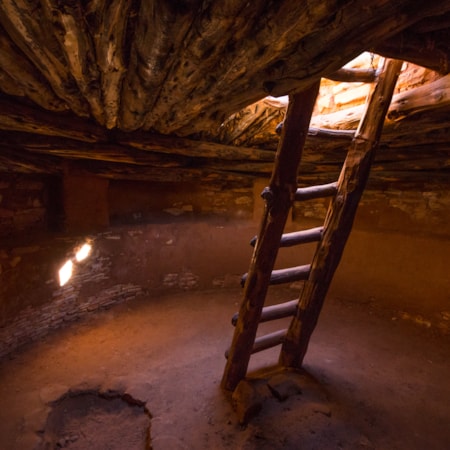
Explore the heart and soul of Bears Ears National Monument
43 Miles
- Stop at Edge of the Cedars State Park Museum
- Let your jaw drop at Natural Bridges National Monument
- Walk back in time at Butler Wash Archaeological Sites and Cave Towers
At Edge of the Cedars State Park Museum, you can begin to wrap your head around this place’s incredible history, which spans thousands of years of human habitation. Learn a bit about the Native American tribes who have called this place home and consider the Bears Ears area to be sacred to this day. You’ll see the largest collection of Ancestral Puebloan pottery on display in the region, and venture into an authentic 1,000-year-old “kiva” dwelling to get a sense of how the land’s original inhabitants lived.
Next, take a beautiful drive into the heart of Bears Ears, stopping at the incredible dwelling sites at Butler Wash and Cave Towers, each a short hike. Then, make your way to Natural Bridges National Monument, where multiple natural rock bridges defy gravity and attest to the power of flowing water to carve the desert into unbelievable shapes. There are many Ancestral Puebloan dwellings to explore here, dating back as far as 2,000 years old. So, take your time to stroll through history and the clues it’s left behind.
Where to Stay
Mexican Hat
Tips for Prepared Travel
Much of this day’s itinerary takes place outside cell service, so bring a proper paper map, know how to use it and plan everything ahead of time. You may not be able to text photos or post them during the day, but you can sure take lots of them to share later.
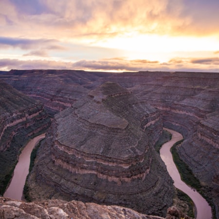
Journey into another world in the Monument Valley area
76 Miles
- Venture into the Valley of the Gods
- Experience the vistas of Goosenecks State Park
- Check out the iconic views of Monument Valley
The Valley of the Gods’ name is no hyperbole. You’ll feel a sense of reverence as you drive the valley’s washboard dirt road through a series of exquisite towering buttes and otherworldly rock formations. Then, you’ll head an hour south to the equally iconic Monument Valley Navajo Tribal Park, beautifully remote and packed with history in its own right. While you can take a few easy hikes on your own, it’s a great idea to hire a local Navajo guide to get the best understanding and appreciation for this rugged — and legendary — landscape.
To cap off an unforgettable day, head back north and make a stop at Goosenecks State Park. 300 million years in the making, you’ll get a firsthand look at the power of water in geology — the San Juan River has cut a series of tight turns or “goosenecks” into the landscape. Take a stroll, take a breath and take lots and lots of photos.
Where to Stay
Either head back to Mexican Hat for another night’s rest before heading home, or point your car northward to begin your journey back to Salt Lake. If you have an extra day to spend, keep in mind that you’ll be passing Goblin Valley State Park and the San Rafael Swell on your way home, and both are worthy of as much time as you care to spend there.
Tips for Prepared Travel
The drive through the Valley of the Gods is a dirt road that is typically fine in an average sedan vehicle. But don’t venture onto the road if it’s muddy at all or there’s rain in the forecast — in such conditions a car can easily get stuck.
